
MIAMI-Hurricane forecasters may have a new tool in solving the vexing problem of understanding storm intensity: gravity waves.
Gravity waves are produced when air moving around the atmosphere gets pushed from one place to another. In a hurricane, those waves can come in quick, short bursts as powerful thunderstorms around the storm's eye wall swish air up and down like a plunger in a toilet bowl. Scientists have long known they exist, measuring them in the stratosphere about 20 or 30 miles above a storm.
Now, for the first time, University of Miami scientists have ventured into the heart of the storm, measuring the waves where they start. And early indications suggest wave power relates directly to storm power.
"The waves are generated in the eye wall, where all the energy is released," said David Nolan, who reported the findings with colleague Jun Zhang in the journal Geophysical Research Letters. "That's why we think it's telling us what's going on with the storm. It's like noise from the engine."
If the connection reproduced on computer models proves reliable, it could provide hurricane forecasters with a new tool in monitoring what remains a stumbling block in hurricane predictions: understanding storm intensity. Improved satellites and super computers that collect and process more data faster have allowed forecasters to make huge leaps in narrowing the likely track a storm will take. But how they intensify, especially when cyclones do it very quickly, continues to lag.
Using measurements from the waves could also provide a simpler and relatively cheaper way to gather information to fine tune predictions because data can be collected from buoys in the ocean or weather stations on land.
"Satellites are really expensive. Planes are really expensive. But barometers are pretty cheap," Nolan said. "This could be a separate, independent way of keeping track of hurricanes and typhoons from a distance."
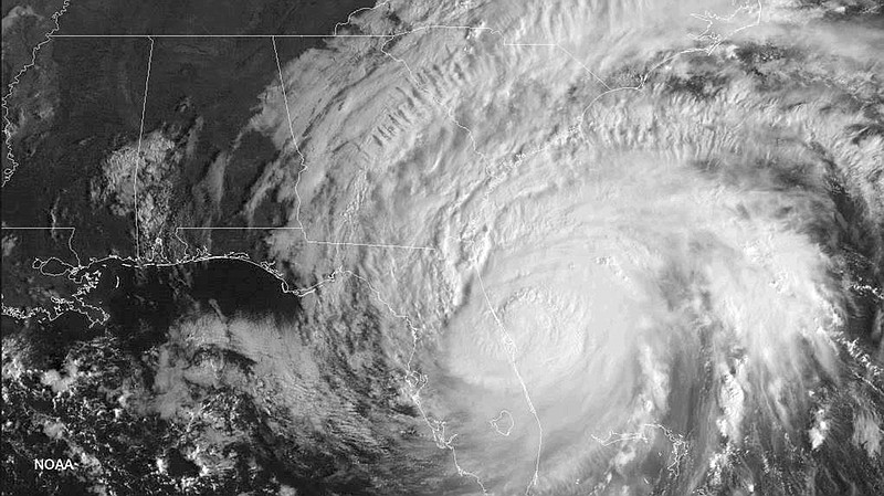
Nolan said Zhang got the idea to look inside the storms after analyzing the subtle rings in satellite images spreading from the eye wall. An atmospheric scientist with the Naval Research Laboratory had first noticed the rings in a picture taken by an astronaut in the Skylab in 1983. Newer computer simulations showed that the rings actually emanate out, a movement subtly reflected in satellite imagery. Zhang suspected if the satellite could detect the images, so could instruments attached to hurricane hunter planes flying into the storms.
So they went back to data collected by a National Oceanic and Atmospheric Administration research plane during five storms in 2003 and 2004: Fabian, Isabel, Frances, Ivan and Jeanne. While other turbulence tended to drown out the waves to flight engineers, once the waves were isolated Nolan and Zhang could see defined waves in the readings, with each one lasting about five minutes.
The pair wondered if ground instruments were also picking up the waves. Luckily, UM's Rosenstiel School of Marine and Atmospheric Science had dropped a buoy in the middle of the Pacific in 2010 for another research project that took readings from three typhoons over three months that year.
Sure enough, the waves could be detected in storms passing several hundred miles away.
To confirm what they were finding, they set up computer modeling to replicate the waves. While the models didn't match up exactly, they were close enough to strongly connect the waves to storm intensity.
In addition to being cheaper and easier to retrieve, information provided by surface measurements could also provide a valuable back-up system for forecasts that rely heavily on satellites, which can fail, or hurricane planes, that can take a long time to reach a storm. It's also a little old school: long before radar and satellites, forecasters relied on reports from ship barometers.
"It is not fantastical to imagine a situation where satellites could be disabled or that the technology is degraded or unavailable, so then you'd really be flying blind," he said.
Nolan, who is careful not to oversell the findings and said much more data need to be analyzed, eventually envisions that a network of buoys and weather stations could act like atmospheric seismometers stationed around the Atlantic and the Pacific, constantly measuring fluctuations in wind and pressure like trimmers from an earthquake. Most stations only collect information hourly, so upgrades would be needed. But during last year's rare Cat 5 Hurricane Matthew, a station fixed to the roof of UM's Virginia Key campus that collects information by the minute provided a peak at the potential for the network.
The team has applied for funding to study the next phase - pinning down how the power and the frequency of the gravity waves reveal what's going on in a storm. Next up would be the buoys.
"It's just like radar was developed for planes and now it's used for weather," he said. "It's something that might take 10 to 20 years to be fully implemented, if it really works."