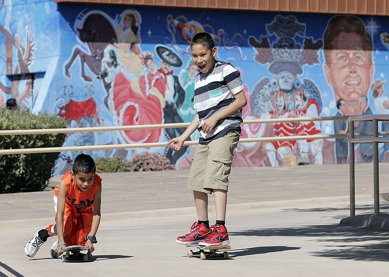
EL PASO, Texas-Sandwiched between the Bridge of the Americas and Bowie High School is a small slice of border history.
The oasis of greenery and culture sits quietly along Paisano Drive, despite being the site of a century-long international conflict.
This year, the Chamizal National Memorial celebrates its 50th birthday-and the 53rd anniversary of the Chamizal Convention Act that settled the United States' last boundary dispute.
With border issues in the news and campaign stump speeches once again, the establishment of the Chamizal holds poignant lessons.
"As a nation, the site can still remind us, if we work hard and are thoughtful, . we can work through diplomatic means to come up with a great solution in the end," Chamizal National Memorial Superintendent F. Gus Sanchez told the El Paso Times. "People from different countries were saying, 'This is our land.' We managed to solve all of that without going to war and in a way that was positive for both nations."
The Central El Paso memorial is nicknamed a "peace park" because not one shot was fired in the resolution of the 100-year-old Chamizal conflict.
In 1848, the Treaty of Guadalupe-Hidalgo established the Rio Grande as the border between Mexico and Texas, which was newly incorporated into the United States. But rivers move, shifting with currents and floods.
A tract of land known as El Chamizal, for the chamisa bush, fell on the Mexico-side of the Rio Grande-until the river "moved." The river flooded nearly every spring, and by the end of the 19th Century, the Chamizal had "switched" sides, now residing on the American side of the Rio Grande.
The Garcia family who owned the land brought the matter to the Mexican government in the late 1800s, saying Americans assumed the land belonged to the United States. The International Boundary and Water Commission also ran into the thorny issue while trying to establish a dividing line over bridges linking El Paso and Ciudad Juarez.
But it wasn't until 1911 that an arbitration committee met to put the matter to a rest. Fernando Beltran y Puga of Mexico, Anson Mills of the United States and Eugene Lafleur of Canada argued over whether the river's change had been rapid or gradual. Under previous agreements, a slow change meant the boundary shifted with the river; a rapid change meant it didn't.
Two of the three commissioners voted to return the boundary to the river's previous course, saying it had changed rapidly, mainly during an 1864 flood. The United States rejected the agreement. Thus began fifty years of stalemate.
The Chamizal again took center stage during President John F. Kennedy's administration. With the Cold War simmering in the background, Kennedy and Mexican President Adolfo Lopez Mateos announced a resolution to the Chamizal dilemma was imminent. After Kennedy's assassination, President Lyndon B. Johnson took up the issue.
The Chamizal Convention Act was eventually signed into law in 1964. The act awarded Mexico 437 acres-366 from Chamizal and 71 from nearby Cordova Island, which was split in two, with each nation receiving 193 acres.
Today's Chamizal National Memorial sits on the former Mexican Cordova Island. Its sister park across the Rio in Juarez also pays homage to the convention.
The agreement also included creating a concrete trench for the Rio Grande to prevent any future deviations.
The Chamizal Convention "is significant because, while there was a lot of heartache and conflict, the two nations settled it without military conflict," Sanchez said.
The agreement meant 5,600 El Pasoans who lived in the Chamizal were moved from land that now belonged to Mexico.
The residents had to leave behind their homes, businesses, neighbors and friends to move elsewhere in El Paso, often at a much higher cost-of-living than in Chamizal, where the land's up-in-their-air status had meant low rents.
The international arrangement was tough for residents, but it also allowed the development of the Border Highway, nearby housing projects and a channelized Rio Grande, Sanchez said.
"A lot of El Paso in this part of town was because of the convention," he said.
One morning recently, students saunter through the Chamizal National Memorial on their way to Bowie High School. Runners loop around shaded paths. A light breeze runs its fingers through the trees.
A stone's throw away is the twice-daily traffic jam on the Bridge of the Americas. Drivers sit in 8:30 a.m. rush hour, but the Chamizal is quiet, a
place away.
Officially authorized in June 1966, it was one of the country's first urban National Parks sites, part of a mid-century shift to protecting smaller spots and cultural and historical centers, in addition to the grant landscapes of the American West, said Sanchez, a 26-year National Parks Service veteran and South Texas native.
"That period was a big period of change for the National Parks," he said. "There was a big push to include other types of parks."
The Chamizal averages about 130,000 visitors a year, not including the Bowie students and other casual passers-through, Sanchez said.
The memorial encompasses the grounds and small obelisks that once demarcated the prior U.S.-Mexico border. But it also includes a theater, museum and regular cultural presentations that tell the story of the place, Sanchez said.
The Chamizal memorial signifies the oneness of the Paso Del Norte Valle, the complexity of border life and how interdependent Mexico and the United States truly are, economically and culturally, Sanchez said. It represents the potential to resolve a tricky conflict diplomatically.
It was a dispute over just 500 acres, and it lasted a century.
"But we did solve it," Sanchez said. "That potential is still there for us. That's an example we should not forget.

