
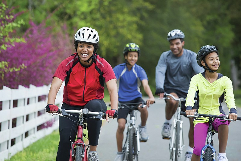
A bike is a game changer when exploring a new city: It's cheap, speedy and a fun way to get in some exercise while on vacation.
From a 1,300-foot climb in Bogotá, Colombia, to a 22-mile, best-of-Paris loop (don't worry, there's wine and ice cream at the end), seven writers offer their favorite rides in cities known for their urban trails.
Copenhagen, Denmark
Head south along the waterfront from the statue of Hans Christian Anderson's Little Mermaid, and you'll soon pass Kastellet, whose cute red barracks belie its status as an active military base, before crossing the cobblestone square that is home to the royal palace, Amalienborg. (Keep an eye out for Prince Frederik, who frequently pulls up to the gates on his cargo bike.) Zip past the candy-colored houses of the old harbor, Nyhavn, and back down to the water's edge, where the old city gives way to the sharp angles of the Royal Library and the chunky architecture of Blox, which houses the Danish Design Center. From here, you can turn left immediately to sail over Lille Langebro, the city's newest bicycle bridge, or pedal on to the serpentine Cykelslangen. Either way, you'll land in the harborfront neighborhood of Islands Brygge, whose swimming area is a favorite spot for winter bathing and summer tanning.
A short jaunt north brings you to the tall masts of artist Olafur Eliasson's Cirkelbroen, or Circle Bridge. From there, zigzag your way toward the Opera House, stopping at the nearby Hart bakery for buttery pastries. Continuing roughly north will bring you to the dramatic swoop of CopenHill -- the Bjarke Ingels-designed power plant and urban ski slope -- and from there, it's only a little further on to the Refshaleoen area, where you can find natural wine and more swimming at the dockside restaurant La Banchina, or tasty fried-chicken sandwiches in the garden at Amass restaurant. Someday, you'll be able to return to the starting point via another bridge, but for now, a harbor ferry that departs from the dock outside Amass makes the crossing. And yes, it takes bikes.
Distance: 7 miles.
Difficulty: Easy.
Good for kids? Yes.
Where to eat/fill up your water bottle: La Banchina, Amass, Hart.
Time to ride: 30-60 minutes, with no stops.
-- LISA ABEND
Bogotá, Colombia
In cycling-mad Colombia, nothing puts a finer point on the country's frenetic obsession with riding than a Sunday morning in Bogotá, when 70 miles of the city's normally gridlocked streets are closed to motor vehicles. From 7 a.m. to 2 p.m., an estimated 2 million people -- nearly a quarter of the city -- take to the streets on two wheels for the closure, called Ciclovía, a mass-participation event dating to the mid-1970s.
But the true fanatics start even earlier. On Bogotá's east side, an avenue leads to the nearby town of La Calera (the road begins just across from a park). There, cyclists begin congregating before sunrise to ride a 3.7-mile, 1,300-foot hill climb called Alto de Patios. By 6:45 a.m., a deluge of riders four and five abreast pours up the hill. The road, just a few car-widths across, cuts pretty oxbows through dense cloud forest as it ascends into the Eastern Hills.
Unlike the laid-back vibe during Ciclovía later in the day, cyclists here jockey for position. The throng of riders is speckled with fans dressed in replica black-and-scarlet Ineos Grenadier jerseys of Egan Bernal, a Tour de France and Giro d'Italia winner from Colombia. And everyone, from would-be racers in Lycra to families with kids on rusted-out clunkers, sprints for the King of the Mountain finish line atop Patios, just shy of 10,000 feet, as if there were real prize money at stake.
Distance: 7.4 miles (there and back).
Difficulty: Challenging. A 1,293-foot climb, but plenty of places to rest along the way.
Good for kids? Older kids who are accustomed to riding will do fine. Younger children will want to stop along the way for snacks and a rest. (They won't be alone.)
Where to eat/fill up your water bottle: Roadside stands.
Time to ride: 30-90 minutes, depending on your speed and if you stop along the way.
-- AARON GULLEY
New York City
The Hudson River Greenway is the most popular cycling route in the city. Riding this path through a series of linear parks on the western edge of Manhattan is your chance to fall in with locals while cruising along the mighty river that helped make New York the powerhouse it is.
You can hop on the Greenway, which is part of the island-circling Manhattan Waterfront Greenway, at multiple points along its 13-mile length between Battery Park, at the southern foot of the island, and Inwood, on the northern tip. But consider launching from the intersection of Chambers and West Streets off Tribeca, where views of the river open up (and there's a Citi Bike dock; $15 per day). Pedal north and keep your eyes peeled for cultural hot spots.
The last stretch of the Greenway involves a killer hill. Instead, turn around at the base of the bridge and meet a treasured local landmark: the Little Red Lighthouse, immortalized in a 1942 picture book beloved by many New York families.
Distance: 13 miles, one-way (length of the entire Hudson River Greenway).
Difficulty: Easy.
Good for kids: Yes.
Where to eat/fill up your water bottle: Grab a seat with a river view at Pier 57's City Winery at 15th Street, off Chelsea.
Time to ride: 1-2 hours of pedaling -- or up to a day if you stop to explore along the way.
-- JANE MARGOLIES
Paris
Paris is a city transformed by bike lanes. Mayor Anne Hidalgo has already spent 150 million euros ($158 million) developing the first stage of the city's bike plan, aimed at making the city "100% bikeable" by 2026, when it plans to have added 112 miles of protected cycling paths.
This 22-mile loop takes advantage of the new cycling infrastructure, mixing in many of the city's main attractions and plenty of green spaces.
route winds through classic Haussmannian architDistance: 22 miles.
Difficulty: Easy to moderate. About 500 feet of elevation.
Good for kids: Yes. The parts with the most traffic are the Bastille roundabout and the area near Trocadéro.
Where to eat/fill up your water bottle: Near République: Dreamin' Man for coffee, or Mamiche has excellent pastries and sandwiches. Near Pantheon: Treize au Jardin, for its lovely and relaxed terrace. Near Île Saint-Louis: Le Peloton Café, for coffee, waffles and bike expertise; and Berthillon is a Paris classic.
Time to ride: 2.5-4 hours, depending on stops.
Bike repairs: La Chouette near the start of the route for any bike tuneups. Friendly staff and very knowledgeable.
-- SOPHIE STUBER
Washington, D.C.
Washington has been bullish on biking in recent years. A number of government agencies and nonprofits oversee and maintain miles of dedicated lanes, bike-friendly roads and gravel trails through the capital, Virginia and Maryland, making the greater Washington area one of the most bike-friendly regions in the country.
One roughly 20-mile loop in Northwest Washington and Maryland -- a local favorite -- meanders through Rock Creek Park and Georgetown and along the Potomac River and the C&O Canal, providing a scenic window to the area's colonial history, vital waterways and abundant green spaces.
The Capital Crescent Trail, a dedicated bike trail, was once the 11-mile Georgetown Branch of the B&O Railroad and now runs parallel to the C&O Canal, one of the country's major transit arteries before the advent of the railroad; parts of it are now preserved. On the Capital Crescent, you ascend slightly as you glimpse rowers from Georgetown University and other boaters on the Potomac, and ride through the soaring Dalecarlia Tunnel or over one of the many rehabilitated railroad bridges. As you bike in a northeast direction, you'll be surrounded with lush greenery.
In the region, there's a tremendous amount of work currently being done to expand bike trails and other public transit options; as a result, one branch of the CCT is currently closed. So enjoy the detour, which will take you past lavish houses in the Maryland suburbs of Bethesda and Chevy Chase as you bike east on streets to pick up Beach Drive again.
Affordable bike rentals can be found at the many docking stations operated by Capital Bikeshare.
Distance: 20 miles.
Difficulty: Moderate, with 300 feet of elevation, at most.
Good for kids? Yes. Many sections on the CCT are flat and on dedicated trails, and the no-cars rule in Rock Creek makes it a family-friendly option on weekends.
Where to eat/fill up your water bottle: Georgetown provides ample places to pick up food or drink, with Baked and Wired selling delicious "cakecups" in various flavors and with almost overwhelming frosting. Many benches can be found in Georgetown and Rock Creek and on the CCT for impromptu picnics.
Time to ride: 2 to 3 hours, depending on stops.
-- ELISABETH GOODRIDGE
Geneva
Here's an easy route that takes you through quintessential Geneva, with a stop in the United Nations area, a cruise along a lakeside promenade, a quick dip in the lake, then a swing past the city's historic center.
From the Cornavin train station, head north up the gently sloping Rue de Montbrillant and into the heart of Geneva's international district. Stop for a wander around the plaza in front of the city's iconic Broken Chair, just in front of the main offices of the U.N. in Geneva. From there, coast downhill to the shady and manicured Parc Mon Repos, then along the lakeside promenade of the Quai Wilson, taking in views of Mont Blanc in the distance if the weather is good.
Set off across the Mont Blanc Bridge, at Lake Geneva's westernmost tip, then pause for a photo of the famous flower clock in the Jardin Anglais. From there, continue along the lake and past the Jet d'Eau -- a fountain that shoots more than 400 feet into the air. Then lock up your bike and go for a swim (or just lounge on the sand) at the public beach at Baby-Plage.
For the final leg, head back along the lake, then wind around the edge of Geneva's Old Town (the Vielle Ville) to the Plaine de Plainpalais, where you can ogle a creepy statue of Frankenstein's monster, who committed murder along this very stretch in Mary Shelley's famous novel. From there, it's a short ride back to the train station.
Distance: About 7.5 miles.
Difficulty: Easy; one moderate climb, but otherwise mostly flat or downhill.
Good for kids? Children need to be able to navigate some road traffic in places.
Where to eat/fill up your water bottle: La Buvette des Bains, along Quai Wilson.
Time to ride: 1-3 hours, depending on stops.
-- PAIGE McCLANAHAN
San Francisco
"The Wiggle" began as a footpath for the original people of San Francisco, the Ohlone tribe. The squiggly path through the city's center allows walkers (and now bicyclists) to bypass the city's legendary hills and enjoy a mostly flat trip from downtown to the shining jewel of the west coast, Golden Gate Park.
It was already a very good park for biking, but recent efforts by Car-Free JFK and others have successfully closed the park's central artery, John F. Kennedy Drive, to car traffic seven days a week. When biking it, you will likely share the road with a mix of retiree cyclists, preteen skateboarders and enthusiastic disciples of the "Godfather of Rollerskating," David Miles.
Distance: About 8 miles.
Difficulty: Easy. About 280 feet maximum elevation.
Good for kids? Yes.
Where to eat/fill up your water bottle: Public water refill stations, Sunflower Garden Vietnamese, Arizmendi, Ebisu Sushi, Wholesome Bakery.
Time to ride: 1-2 hours, depending on stops.
-- NINA F. ICHIKAWA
This article originally appeared in The New York Times.